


I’m not sure how I managed to live in San Francisco for a year without knowing that Rodeo Cove existed. Why is everyone rushing off to Stinson Beach, when Rodeo Cove is closer and easier to get to? (And not likely to involve sitting in traffic on a one-way highway for a half hour.)
Rodeo Cove is at the western edge of the Marin Headlands, and involves a soft pebbly beach and fully paved hiking trails overlooking the Pacific. In the spring, the whole area is a lush apple green and it is one of the most perfect spots for an afternoon picnic.
This day trip kicks off with a hike through the Marin Headlands and some rest at Rodeo Beach. Later, we pay a visit to the wonderful Marine Mammal Center and Golden Gate Bridge overlook, before heading to dinner at Fish in Sausalito.
Day Trip to Rodeo Cove and the Marine Mammal Center
Recommended Itinerary: (10 hours, 30 driving miles, 1.5 walking miles)
- Drive to Rodeo Cove in the Marin Headlands
- Hike up to gun batteries of Fort Cronkhite
- Have a picnic overlooking San Francisco and the Golden Gate
- Hike down and relax at Rodeo Beach
- Take a tour of the Marine Mammal Center
- Enjoy a sunset over Golden Gate Bridge at Hendrik Point
- Dine at Fish in Sausalito warehouse/dock district
What you’ll need:
- A car
- A backpack
- Bottles of water
- Picnic foods
- Picnic blanket
- Sneakers or boots for an at-times rugged hike
- Windbreaker and fleece
- Change of clothes for dinner (optional)
1. Drive to Rodeo Cove in the Marin Headlands
Our trip starts off like all northerly trips with a morning crossing over the Golden Gate Bridge. This is quite unlike crossing the Lincoln Tunnel out of Manhattan or 14th Street Bridge out of DC. You want to scream ROAD TRIP out your window like those kids do in the movies. The city ends so abruptly and before you know it, you’ve been swept into the beautiful Marin Headlands, all rolling green hills. None of this seems very fair. Part of living in a city is the struggle to get out of the city on the weekends (I still have nightmares of being crushed to death in Penn Station as the Friday evening Amtrak train pulls in). San Francisco has somehow figured out how to manage this, all while giving you a beautiful blazing orange send off to boot. We’re spoiled.
After crossing the bridge, take exit 442 onto Alexander Ave and then veer left onto Bunker Road. You’ll travel on Bunker Road for 2.5 miles. Pay close attention to street signs at the forks in the road to make sure you stay on Bunker Road. As you come into view of the Rodeo Lagoon, veer left onto Mitchell Road. You will see a large parking lot in front of you. On our Saturday trip, we had no problems finding parking. Note that there are restrooms at the head of the trail.
2. Hike up to the gun batteries of Fort Cronkhite
First, take a moment to take in your surroundings. Children and dogs will be playing in the lagoon in front of you, while families stroll across a low pedestrian bridge over the lagoon to the pebble beach up ahead. Surfers have lined themselves up a few yards out on the water, every now and then rushing to take off on an incoming wave. The cove is protected and hidden by the overlapping emerald cliffs, making it feel like a secret paradise.
Behind you is Fort Cronkhite, now a dozen or so two story structures with bright red tile roofs, lined up in crisp rows. It was a WWII military post (no, San Francisco never saw any military action), and now holds National Park Service and non-profit offices.
I’m not sure what kind of lottery those soldiers won that they were stationed at this beach, looking out over the peaceful Pacific Ocean every day. Interestingly and irrationally enough, the San Francisco Bay may have actually been the most fortified site in the U.S., according to Kevin Starr’s Embattled Dreams: California in War and Peace. I’m sure it had nothing to do with those beautiful views…
(Ha! We were right! “Most everybody wanted to be stationed here,” said Elizabeth Weston, a volunteer with the Golden Gate National Parks Conservancy. “It was the prize.” Via The New York Times)
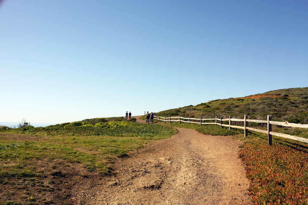
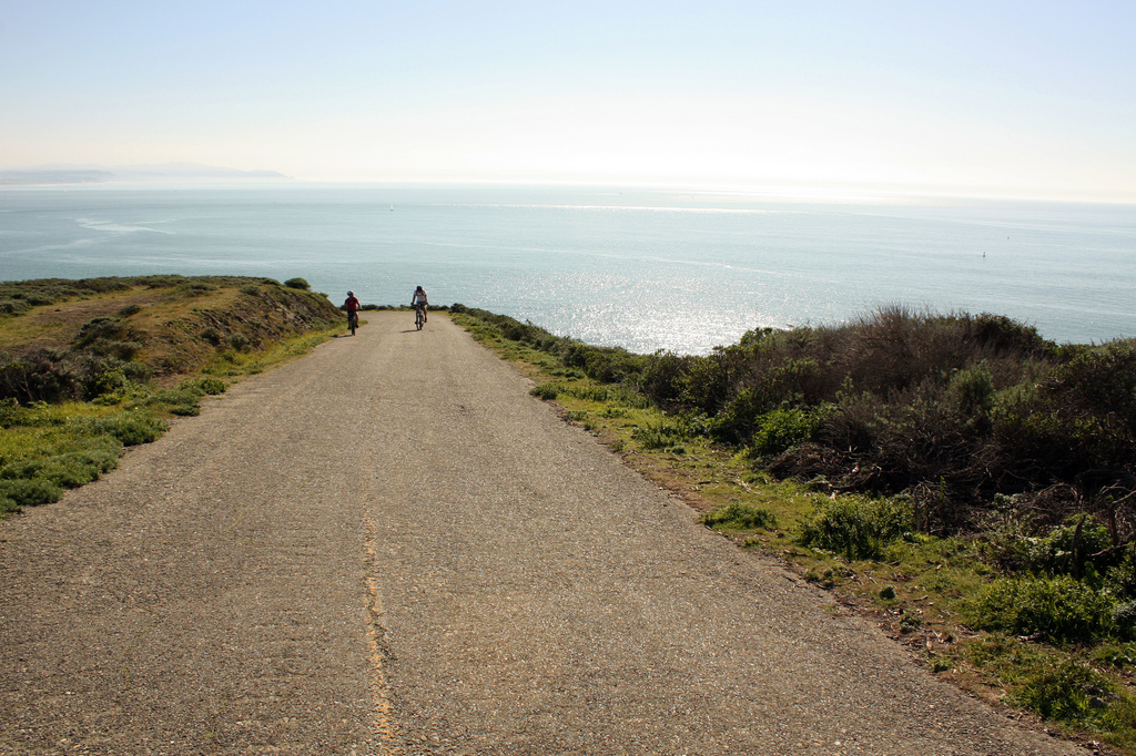
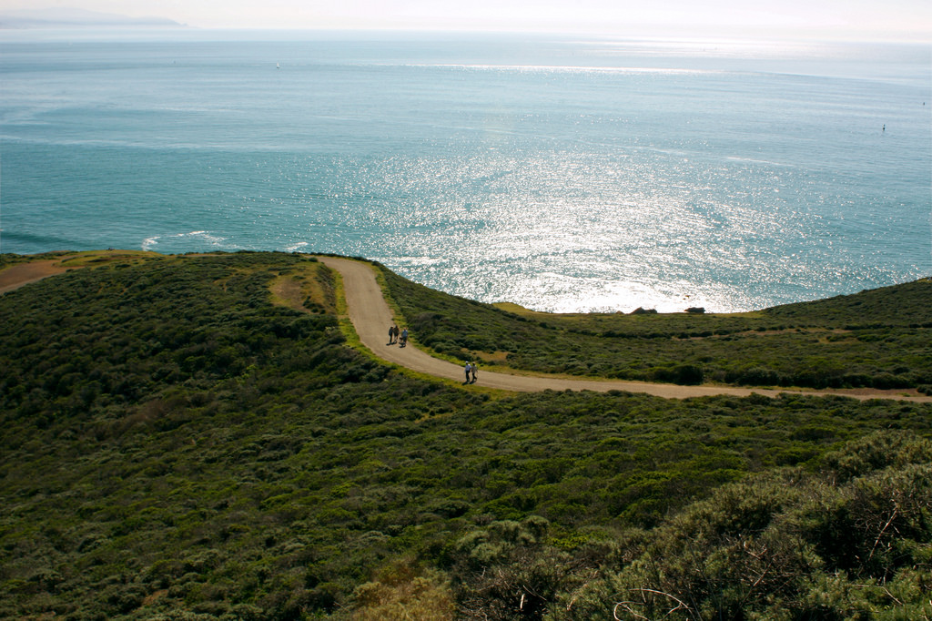
The trail straight ahead is wide and paved, a remnant from soldiers who needed to drive supplies up to the gun batteries. The hike begins easily enough, curving up and around the cliff side, not much separating you and the ocean below. The Fort will slowly disappear from view, and the hike will become increasingly peaceful. On a clear, calm day in February, we did not come across many other day hikers.
As you continue on your hike, you will pass numerous gun batteries, now graffitied concrete structures burrowed into hillsides. Following the attack on Pearl Harbor, these batteries were continuously manned, 24 hours a day, in anticipation of a Japanese attack. The soldiers slept in the small rooms that are now gated off, without running water and typically shrouded in darkness – black out rules were in effect for the entire California coast. (This site is amazing, and why I love the internet: 6th Battalion, 56th Artillery: The Fort Cronkhite years. This PDF provides a walking tour of Fort Cronkhite.)
I’ve been saving the best for last, though. Once you’ve reached a high enough altitude, you’ll be able to see the entire city splayed out for you. It’s surprising to say the least, in a “what are you doing there, city?!” kind of way. The Transamerica Building, the Golden Gate Bridge, the Presidio, the Richmond District, and even Golden Gate Park and Ocean Beach stretch along the northern horizon from east to west. You’ll see many cleared off plateaus (thanks, Army!) on your hike, so go ahead and pick a flat stretch to roll out your blanket on, preferably where you can gaze upon the city far, far below.
3. Have a picnic overlooking San Francisco and the Golden Gate
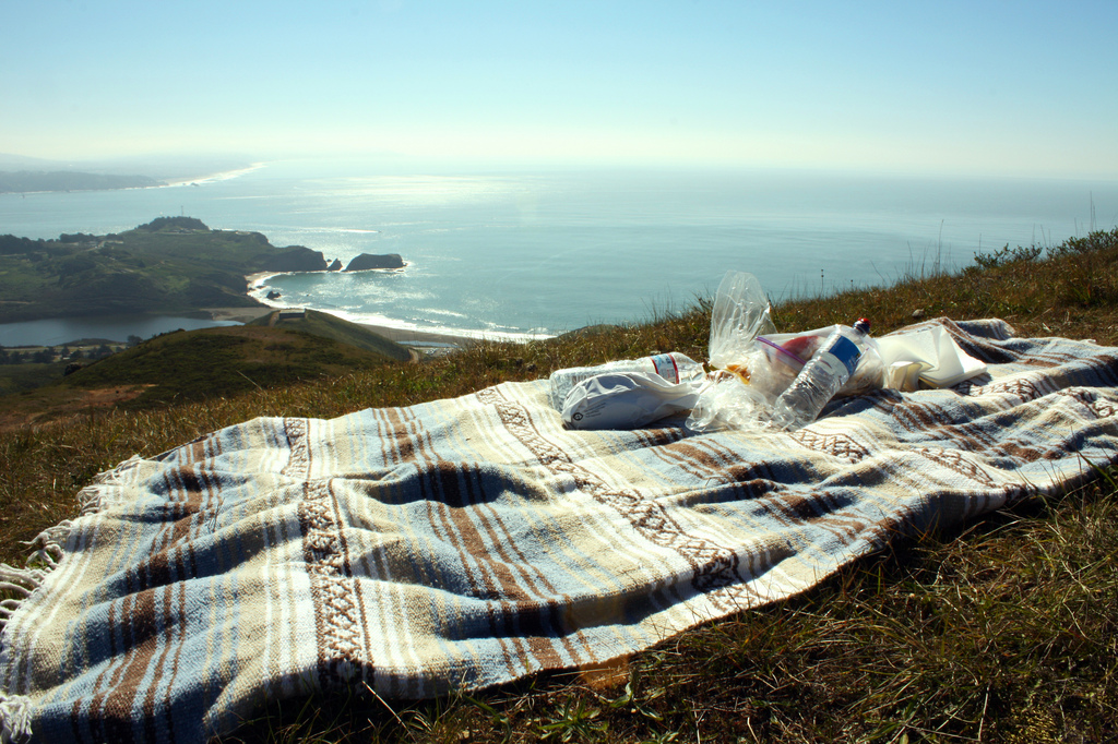
Sometimes when you are out hiking, you come upon vistas that are so grand and so incomprehensible that you are so awestruck as to be rendered speechless. I’m not sure if we spoke at all during our lunch, but I’m sure that if we did, it was to grunt that a ship was making its way through the Golden Gate. Or, to point out a site in the city that we were amazed to be able to see from here. Or, to say hello to the rare passing hikers (I’m not sure what it is about hiking, but everyone was so friendly up at that elevation!)
It was fascinating to see the entire Golden Gate, within the context of the California coastline. It’s just so very narrow, isn’t it? It suddenly made sense that the first Spanish explorers took nearly 250 years to discover it – they kept on missing it either due to rough waters or simply not noticing it. (The Spanish finally discovered the entrance to San Francisco Bay in 1775, while Santa Cruz was settled in 1535.) The narrow channel that opened into a massive bay, ringed and sheltered by 1,000 ft high hills from the Pacific surf, was instantly recognized as an ideal site for a settlement.
The channel also saw the US Indianapolis off in July 1945, carrying enriched uranium for the atomic bomb that would be dropped on Hiroshima. Although I’ve been poking fun at the soldiers stationed here, the San Francisco Bay was a major port of entry and exit for military personnel battling the eastern front of WWII. I wonder how San Francisco’s history as a critical military installation transformed itself into the modern peacenik city we know today. How did that transition happen, or better yet, is the reputation unearned?
4. Hike down and relax at Rodeo Beach
After lunch, head back down the trail to Rodeo Beach. We had some trouble following the path on the way down, due to so many improvisational paths forged by hikers looking for short cuts. The path down is much more delightful than the path up, since you face the ocean almost the whole way down. As the sun dipped lower in the afternoon sky, the water shimmered like a sequin dress under a disco ball.
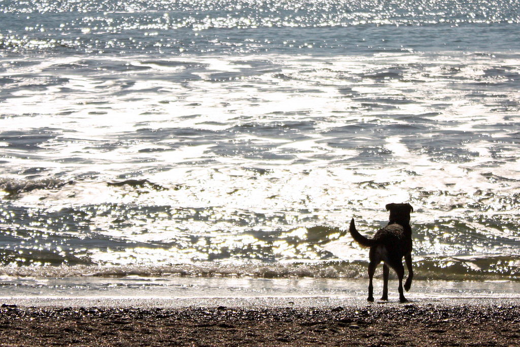
Our pit stop at Rodeo Beach was short, just long enough to marvel at the round, pillowy pebbles that comprise the beach and the surfers riding the silver waves. Dogs, impervious to the chilly water, bounded in the crashing waves playing fetch. It is a nice spot to take a rest, perhaps take a restroom break, and de-sweat-ify yourself before returning to civilization.
Once you are ready, head back to your car and head back down Mitchell Road towards Bunker Road. Midway along the lagoon, take a sharp left to turn onto Bunker Road. Take a right a few feet after your turn, at the sign for the Marine Mammal Center.
5. Take a tour of the Marine Mammal Center
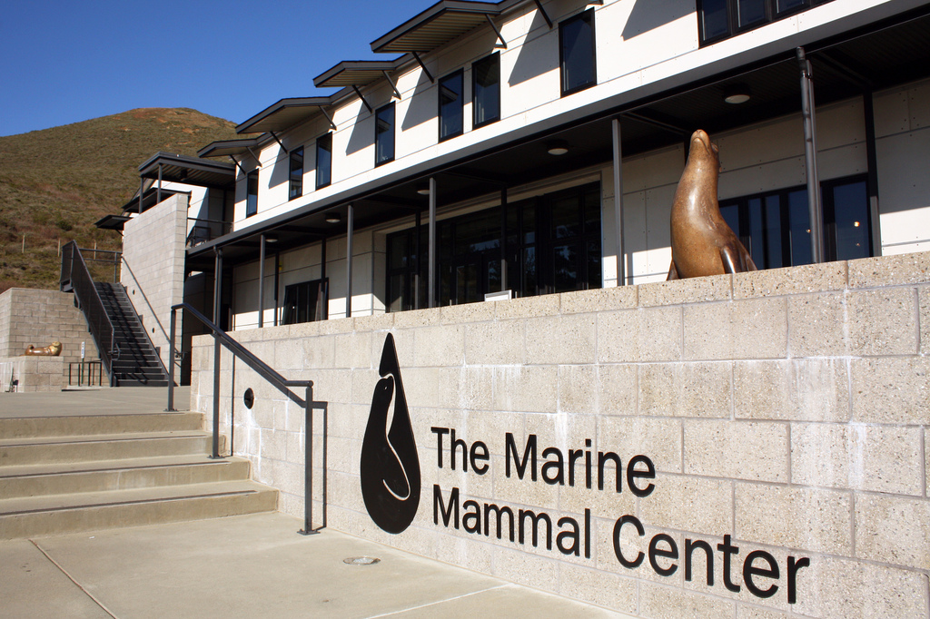
The Marine Mammal Center is a functioning hospital for injured marine mammals that volunteers and citizens discover on the shores in the Bay Area. I’m happy to report that on our visit, the facility only had 8 patients – in the year before, it had over 200 animals in its care at one time. I cannot imagine a more perfect outing for any child who has an interest in the environment, biology, or wants to be a veterinarian when he or she grows up.
We chose to take the audio tour (earphones, MP3 player, $7 for adults, $5 for seniors and children) and enjoyed it immensely. The Center also offers Docent-led tours two to three times a day for the same price. The Center is currently offering $2 coupons that you can use on your next visit.
The facility is very well maintained, with outdoor hallways that guide you past glass-walled workspaces, like the center’s kitchen, labs, and pharmacy. The audio tour begins by describing the difference between an elephant seal, sea lion, and harbor seals. Do you know? Sea lions have ears and seals do not. (I will not have remembered this in a week.)
The tour guided us to a platform overlooking the outdoor pools that house its patients, while describing (in sometimes brutal detail) how the marine mammals ended up here. The combination was truly sobering. Some of the animals had, well, human conditions – cancerous growths and kidney infections. Others were indirectly and directly harmed by humans – the worst being Arrow, a five month old sea lion who had been shot with a crossbow arrow (her attacker was later found and fined $4,000).
It’s not all sadness, though. A great wall display tells the stories of those animals who had been rehabilitated and released. The most heartwarming was Harley, a deaf sea lion that was found stranded on the beach. Harley now lives in the Milwaukee County Zoo, and works with a team of zookeepers that were specially trained in sign language.
For biology geeks out there, the tour also takes you through the kitchen, where a “herring-o-matic” (no really, that’s what it’s called) prepares a herring pulp that doctors tube feed the patients. You will also see the pharmacy and medical laboratories where scientists test patients’ blood and tissue for diseases.
The eeriest, but perhaps most necessary room, is the autopsy room. It is behind a closed gate, so you don’t have to see it unless you make the effort to. I sent my husband in first to confirm that there currently weren’t any animals on the operating table. Despite all the happy rehabilitation stories, this room silently let us know that not all stories end with a triumphant, healthy seal riding through the waves into the beckoning ocean. Through autopsies, though, scientists here are able to further scientific research into treatment methods and prevention programs.
After a walk through the gift shop, return to your car. This might be an opportune time to change into your street clothes, if you’ve brought them. Head back down to the intersection of Mitchell Road and Bunker Road, and veer left to stay on Bunker Road.
6. Enjoy a sunset over Golden Gate Bridge at Hendrik Point
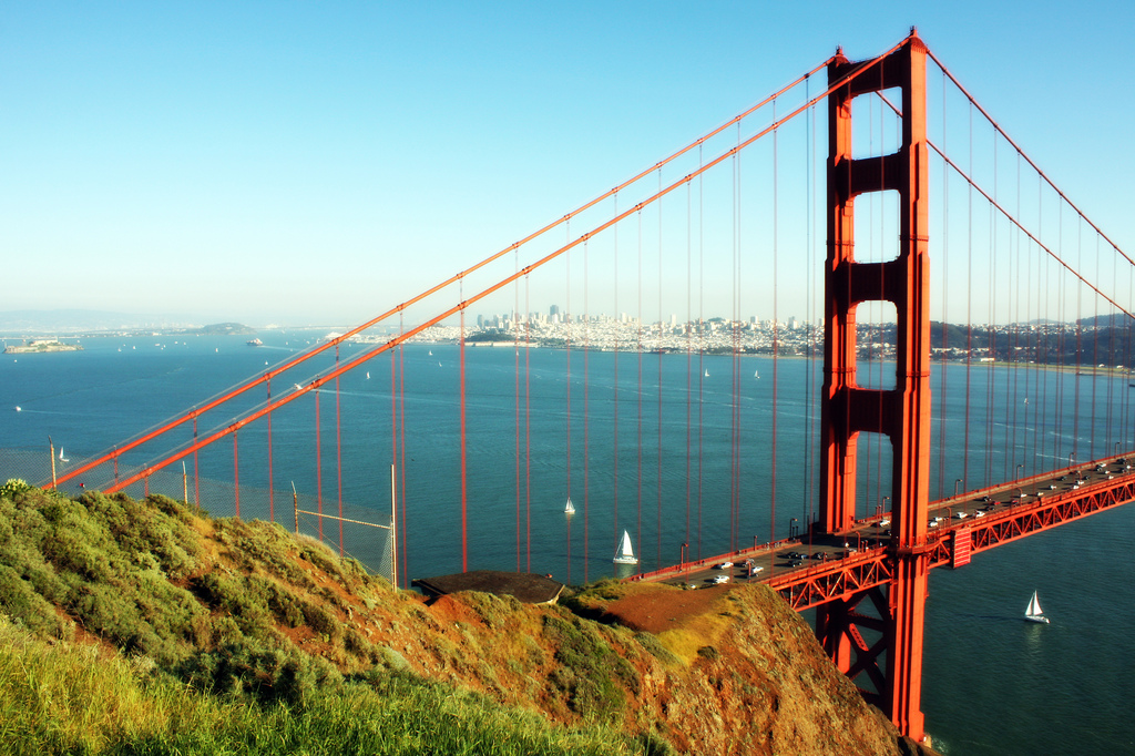
Drive two miles on Bunker Road and turn right onto McCullough Road. At the traffic circle, turn left onto Conzelman Road. Drive up and on top of the ridge and prepare yourself for stunning views of the Golden Gate Bridge. In the late afternoon sun, the Golden Gate Bridge will be on fire, with the hazy outlines of downtown San Francisco in the background. Cars litter the two way road for miles as photographers try to recreate those iconic photos of the Golden Gate Bridge (you know, the ones that pop up in the intro to the evening news and post cards through out the city.)
The most official looking turn off is Hendrik Point. It is the last, and largest, parking lot before Conzelman Road begins descending the Marin Headlands. Me: (upon seeing the view) “So, THIS is where everyone’s taking those photos from!”
It will get chilly as the sun begins to set, so come prepared with a blanket, a heavy jacket, or at least a windbreaker.
Once it has gotten too windy and chilly for comfort, head back to your car. Continue traveling on Conzelman Rd and merge onto 101 North. Take exit 444 and turn right onto Rodeo Ave. Turn left on Nevada Street, and then turn left on Bridgeway. Turn right at Harbor Drive. Fish will be just ahead, on the water.
7. Dinner at Fish in Sausalito’s Warehouse/Dock District
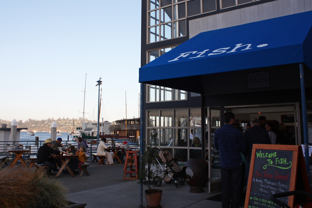
Fish is having a popularity moment right now. I believe half the population of Sausalito was in line ahead of us when we got there at 5:30, when they open for dinner. I can say that their popularity is well deserved, because we had a phenomenal meal.
The restaurant takes its cue from all the beach front lobster shacks in the Northeast – you order at the counter, sit at picnic tables, and the food is delivered. Like the lobster shacks in Maine, the informality belies the extravagance of the meal. None of the food is cheap but all of it is fresh and delicious and heart stopping.
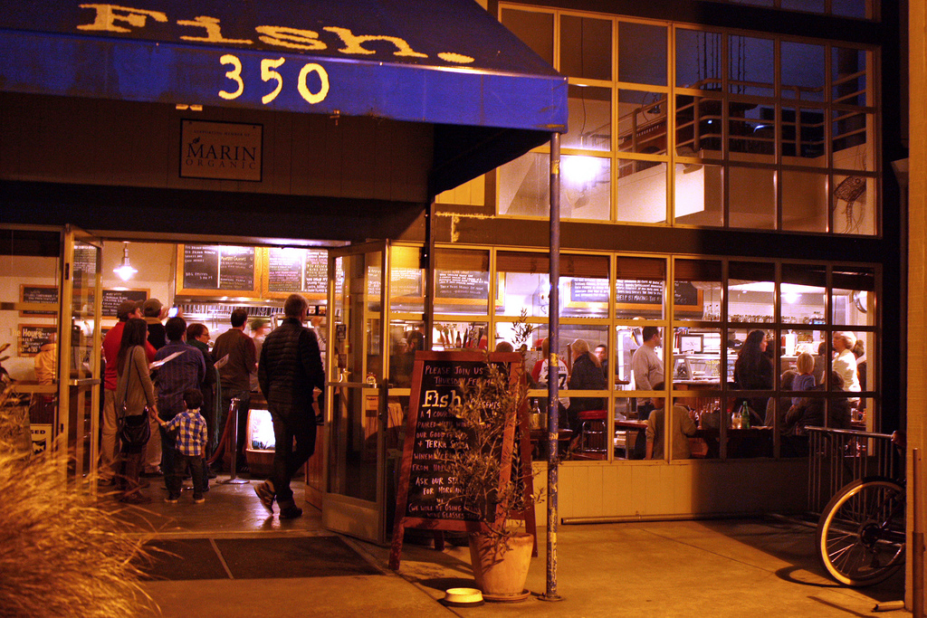
The location is pitch perfect. The restaurant is surrounded by warehouses (and the Heath Ceramics factory) on the docks overlooking the bay. Inside, massive glass windows frame the rows of sailboats swaying back and forth outside. The kitchen is open, and we greatly enjoyed sitting at the bar, watching the cooks and wait staff race frantically around to satiate the demanding crowd.
We each ordered the Dungeness Crab Rolls. The restaurant mixes a mountain of crab meat with butter and chives, and serves it on a buttered roll. I’m not sure why other restaurants aren’t doing this. At the time, I argued that the crab roll may be even more delicious than the lobster roll at Pearl Oyster Bar in New York. (My husband disagreed – he argued that crab can never trump lobster. Regardless, he asked that I recreate the dish only three days later at home, cholesterol count be damned.)
Be warned that the restaurant does not take credit cards, and that a meal here can easily exceed $40/person.
To return to San Francisco, head back to the highway and get on 101 South. Only in San Francisco can you have a day like this, and be only 11 miles from home. We are truly spoiled.

A Civil Rights Walk through San Francisco | Far Out City
[…] is all particularly interesting to me after all my research into Fort Cronkhite, in the Marin Headlands. In the months after Pearl Harbor, the US really was in […]
4/7/2011 at 11:48 pm
Our Russian River Valley Pinot / Syrah Tasting Tour | Far Out City
[…] park is stunning, and I mean that in many ways. Like Fort Cronkhite, the park unravels along grassy cliffs overlooking the sea. Unlike Rodeo Cove, the crashing surf […]
5/6/2011 at 9:44 pm
On the Road: A trip to Cowgirl Creamery and Point Reyes' Tule Elk Reserve | Far Out City
[…] Hiking around the Marin Headlands and a Golden Gate Bridge Sunset […]
9/12/2011 at 8:06 pm
Guest City: Washington, DC -- A Food Lover's Guide to DC, Mid-Priced Restaurants | Far Out City
[…] Hiking around the Marin Headlands and a Golden Gate Bridge Sunset […]
3/2/2012 at 4:07 pm
Photo of the Day: ROA's Sea Lions | Far Out City
[…] Hiking around the Marin Headlands and a Golden Gate Bridge Sunset […]
3/6/2012 at 5:04 pm