


I know, must-have is quite a high bar. But, over the past year and a half I’ve been using Quicky Transit, I have to say: I don’t know how I rode the bus in San Francisco before it.
It’s even more critical now, with a toddler in tow. Waiting 25 minutes for the next bus isn’t an option, so Quicky is actually useful in two parts. First, letting me know that my wait is going to be 25 minutes. Second, locating all nearby bus stops and then letting me look at a map of each route (with images of where each bus on that route currently is) to figure out an alternate route home. Or, maybe I decide that 25 minutes is enough time to run to a nearby market and pick up some groceries before the bus comes, or I let Bean play at the playground a little longer since it’s going to be a while.
Basically, the app gives you a ton of information, so that you can plan out your transit trip.
Then, you can become an expert user and use the app to estimate what time you might get to a transfer point so you’ll know whether you’ll catch the next bus or streetcar. While I’m on the J-Church, I can look up Duboce and Church Streets and see that I’ll be there in around 8 minutes and that there will be an N-Judah arriving 4 minutes later. Or, I’ll notice that there won’t be another N-Judah for 12 minutes and maybe I should hop off at 18th Street because there’s a 33-Stanyan arriving in 3 minutes and that will be a faster alternate route to Golden Gate Park.
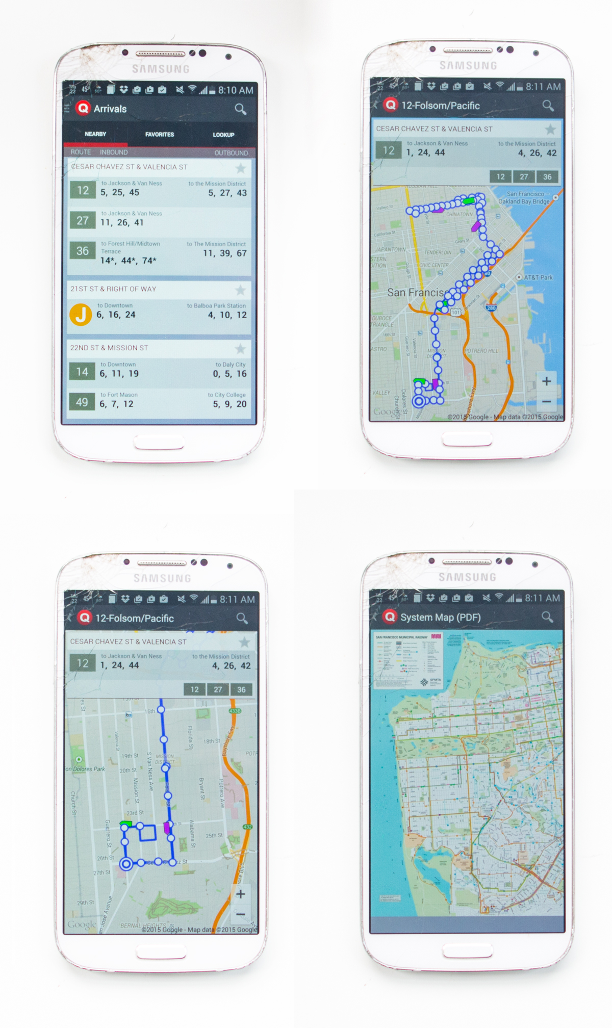
Ok, let’s walk through the images above.
In the first window, that is a list of nearby stops, based on your GPS location. You can scroll down and pick other stops, too, say if you’re planning on walking a half mile to a certain bus route. You can also pick “favorite” stops — we pass through Duboce and Church enough that I have it listed as a favorite. Then, if all else fails, you can choose to look up a route and stop in that last tab.
If you press on a route in your nearby stops window, you’ll be taken to a new window showing the entire route on a map. Your current position shows up as a blue dot (I erased it in the images above, but it will work on your phone.) The white circles are the bus stops. You can zoom in and see where all the buses on that route currently are, and then watch them make their way to your stop. The buses show up as either magenta or green, depending on which direction they’re traveling on the route. This is helpful if you’ve never taken a route before — you can see where you’re going and where the stops are.
Finally, if you just want general transit information, you can look up a map of the entire SF transit system, right there on your phone. If you’ve ever tried to download MUNI’s bus map on your phone, you know how nice it is to just have it right here in this map. So useful.
———————————————-
The Quicky Transit app is free and available for Android phones.
